 |
 |
Ocean Ridge DevelopmentLocated in beautiful Robbinston, Maine, cut out of 100 acres of property, you will find twelve spectacular Ocean View Lots. "Ocean Ridge Development" is brand new, but the property has been in the family for years. Owner Ron Mahar decided to create these lots to have great neighbors, and to share the rare opportunity to own some of the last Ocean View property like this anywhere. |
|
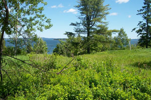 one of the beautiful Oceanridge lots |
Robbinston, Maine is a quiet village on Passamaquoddy Bay, with a beautiful state owned picnic area with a fantastic boat ramp where you will be able to cruise up and down the St. Croix River into Passamaquoddy Bay. On the right headed North is Canada, and on the left is the United States. |
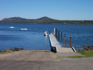 State-owned boat ramp |
The State-owned boat ramp, 1/4 mile north of Ocean Ridge, gives easy access to the St. Croix River and Passamaquoddy Bay. |
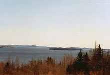
 View of St. Croix Island from Ocean Ridge |
While headed North you can drift onto St. Croix Island for a visit. Saint Croix Island, located along the United States and Canada border between Maine and New Brunswick, is the site of the first French settlement in North America. A 1604 expedition, led by Pierre Dugua, Sieur de Mons, established the settlement on St. Croix Island. Cartographer Samuel Champlain was among the crew. |
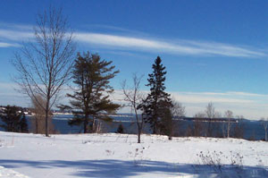 winter view of St. Andrew's, NB, Canada |
South from "Ocean Ridge Development" by land or sea is St. Andrew's NB, Canada. Also south is Eastport, Maine and the most Easterly point in the United States, Lubec, Maine. |
 |
Ocean Ridge Development lots are priced very reasonably, from $49,000.00. All lots are soils tested and approved. Early bird owners buy entire subdivision for $895,000. Lots of privacy or a great family estate! Only in Robbinston Maine, can you find such beautiful property with spectacular ocean views, low taxes, and friendly people. The perfect place to retire or to bring up your family! Maine....the way life should be. |
| Click any photo above for a larger view. Click here for more photos. Click here for lot plan. Click here for maps. |
|