|
|
 |
|

|
 |
|
|
My team ascended the normal West Buttress Route,
which covers more than 15 miles and rises more than 13,000'/4,000 m. to the summit from a 7,200'/2,200 m. base camp. Although
the route is not technically difficult, successful ascents typically last two to four weeks because of its length and rise
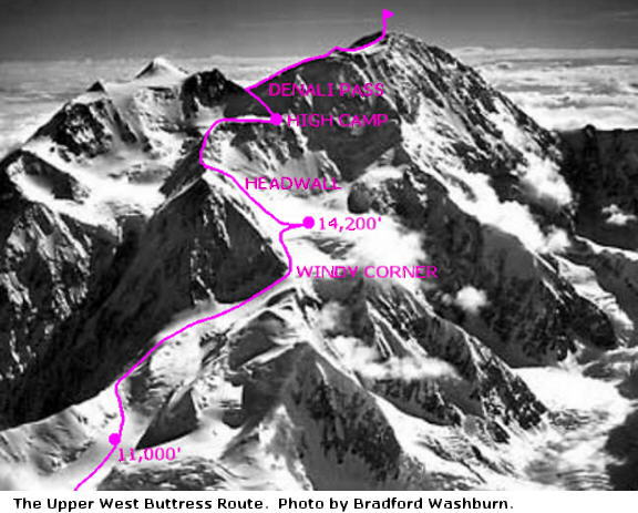
in elevation and the mountain's difficult weather. Bradford Washburn pioneered the route in 1951, after identifying
it on his meticulous and beautiful photographs of the Alaska Range.

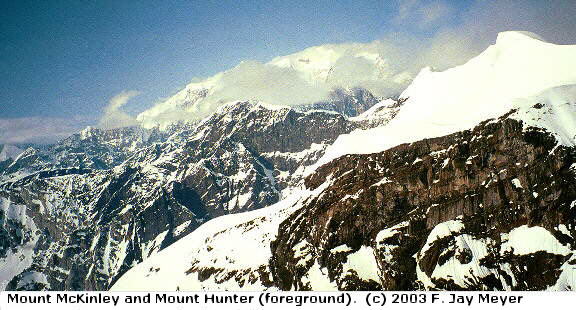
From its beginning on the Kahiltna Glacier's Southeast
Fork at the foot of Mount Hunter, the West Buttress Route follows the glacier's main branch up increasingly steep terrain
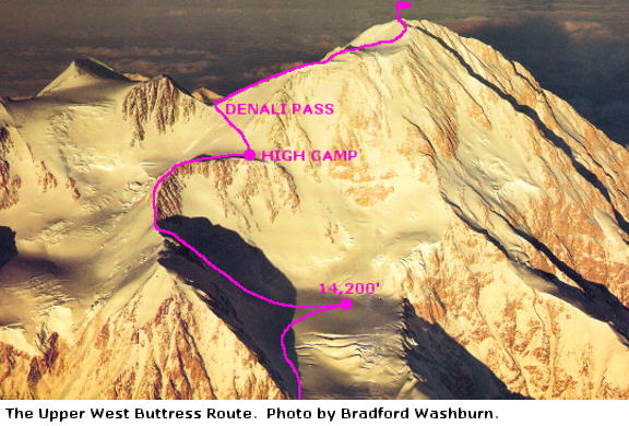
to a large basin at 14,200'/4,300 m. Above there, the character of the route changes as it leaves the glacier and climbs
a headwall and then the West Buttress' narrow rocky ridge to a high camp at 17,200'/5,200 m. Between high camp and the
summit, the route first makes an exposed traverse up to Denali Pass at 18,200'/5,550', then ascends open slopes to the base
of the final, steep Pig Hill and its corniced summit ridge. The headwall and ridge of the West Buttress are the most
technically challenging portions of the route; the top of the headwall is steep enough to justify fixed lines for protection.
But summit day, and particularly the descent from Denali Pass back to high camp, can also be very dangerous for exhausted
climbers suffering from high altitude and frigid temperatures.

Next: Preparing
(c) F. Jay Meyer 2007 All Rights Reserved
|
|
|
 |

